A TOUR OF THE TOWN OF UNION
...Spring 2007...
Bob Tilden
On a pretty day in May of 2007 My wife Donna and I set out an all- day genealogy expedition.
We had recently learned that we were BOTH descended through Seth Dann, and were interested
in tracking down her family {Letteer) in Lycoming County, and of learning more of the families'
histories in the Town of Union.
We visited cemeteries and found all the headstones that we had hoped for, including Samantha
Dann Letteer, the link between the two families. She was a daughter of Abijah and a
granddaughter of Seth. "Our" A. J. Dann was a grandson of Seth. A cemetery tour is elsewhere on
the site.
The Dann family lore was that Philip's farm was located just across the town road from the
cemetery in Union Center, but after knocking on their door, we found this wasn't so. The third
door we knocked on produced an older man who said "See those silos between the roof and silos
of the farm just down the road?... They are Spencer's silos, and Erwin Spencer can tell you all
you need to know"
I should add at this point that the proper name for the Dann or Union Center Cemetery is the
"Swamp Cemetery" The original name for the crossroads of Union Center was simply "Swamp".
In the earliest years the area was swampy because of its numerous springs, even though the land is
sloped. The springs were quickly channeled and the area made suitable for farming. The church,
the school, and the grange hall and the cemetery all carried the title "Swamp".
A knock the Spencer's farmhouse produced Erwin Spencer, a fourth cousin to all Danns of my
generation (I am 60). I inquired whether he was the fellow who could tell me all about how things
used to be, and he said that his wife could do a better job of it, and that she was out in the barn.
We found Diane, her hair covered with a blue bandanna, pushing wheelbarrow loads of ensilage
around the perimeter of the barn, dropping a few shovels- full in front of each of their three dozen
milkers. I think she was initially annoyed at the distraction, but when she found that my interest
went beyond a Sunday drive in the country, Erwin was given the wheelbarrow and we went back
to the house to talk history.
Their farm is more or less the farm that was created by Alpheus Dann, a brother of our A. J. and it
also includes land that was originally settled by Alpheus and A.J.'s father Philip Dann in 1840. It
has been in the "family" continuously since that time.
Alpheus died while in the Union Army, and his wife Margaret Barker Dann continued to run the
farm through all her working years. Her daughter Anna married Wesley Barrow and their son was
Ray. Anna died young, Wesley re- married and Ray went to live with his grandmother Margaret.
After signing the farm to Ray, Margaret "retired" to the house just east of the Swamp Grange
hall, and spent her final years in the home of her daughter Mary Evangeline Dann Scudder in
Coopers Plains New York.
Ray's daughter married ***** Spencer who operated the farm after him, and today the farm is
operated by their son Erwin and his wife Diane. Diane was a Griswold, another long- time Union
family, and neighbors of the Dann farm.
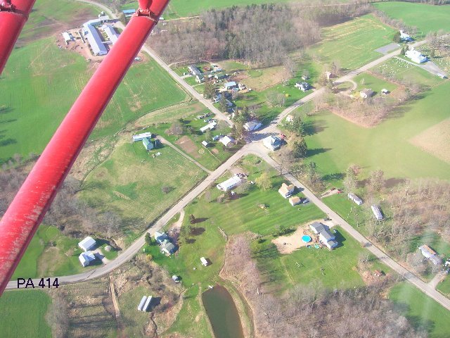
Ogdensburg, viewed from above, looking southwest; The Ogdensburg church and cemetery is at the upper right. State Route 414, left to right, is the main road crossing the township east to west from Canton to Liberty, but the town road which crosses north and south was once the "Yankee Path" a significant trail which cut over the hill from Roaring Branch to Blossburg, a 12 mile trip versus a 90 mile trip by way of the river valleys or later, the railroads.
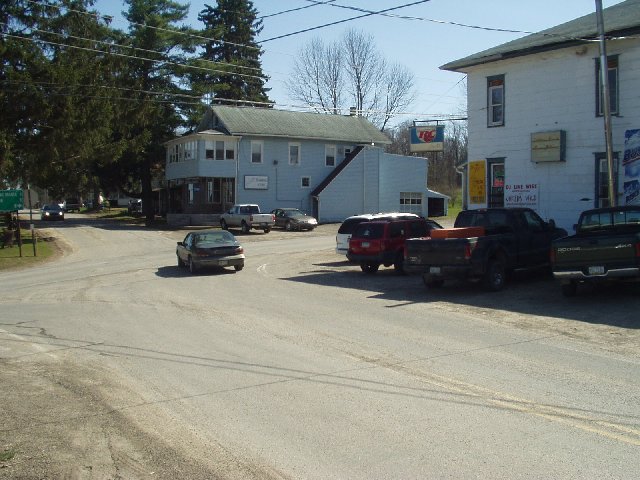
The 4- corners of Ogdensburg , looking south.
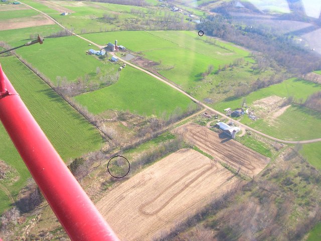
This photograph is centered upon the Spencer farm, but also shows the two Philip Dann homesites. Circled in the distance is the site of the original 1841 cabin, and corcled in the foreground is the site of the 1854 frame house. I should add that family lore has this as Philip's home site, and it is at the location shown as his on the 1862 map. A check of deeds sometime in the future should verify this.
Another view of the original cabin site. It was located in the grassy spot which is centered in the picture.
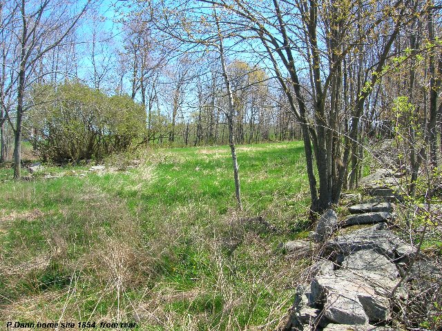
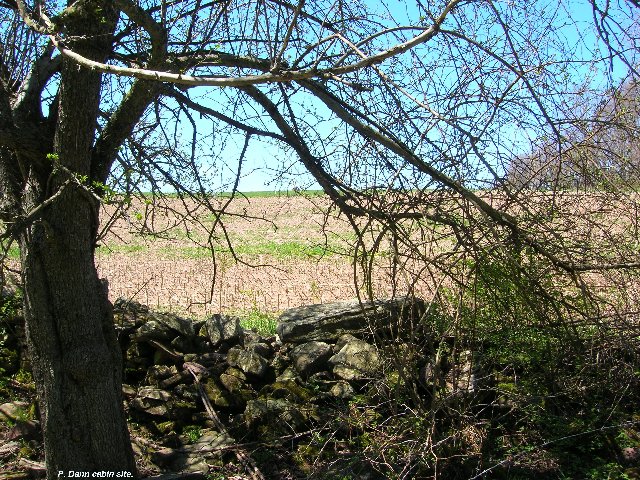
This photograph shows the site of the 1854 frame house from the rear looking east. Note the thicket of lilac bushes at the front of the foundation; the stones barely visible in the grass are the top of the foundation walls, about 25 feet square. Photographs sometimes fall far short of what our eye can see, and pictures of the cellar hole taken from the front, through the lilacs, did not show the stones well.
The cellar hole is mostly filled with trash from more renent owners, but Diane remembers as a girl, walking within the hole and noting the neat stone work. She says it was deep, a real cellar, not just a crawl space. The line of stones on the right side of the picture is a stone wall.
The original part of the barn, likely built by Philip, near the 1854 homesite. Like most barns of the times, the livestock were "downstairs", bunkered on two or three sides from the wind and weather. Diane remembers the original wooden stanchions which were still in use when she was young.
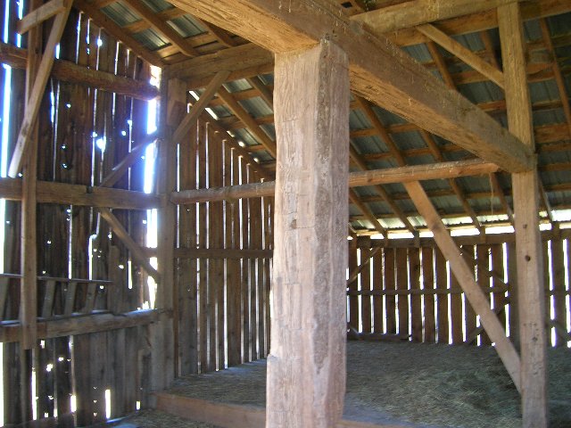
The hay loft of Philip's barn. This was at a drive- in level from the outside, above the livestock. The barn makes a poor picture from the outside because only the southwest part is "original" and is mostly obscured by the successive additions.
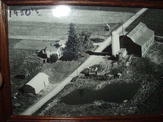
This is a picture of the Spencer Farm taken in the 1950s. Note the large tree in the front yard which almost overpowers the house. I remarked about it and was told it was "Margaret's tree", and removed with with reluctance.
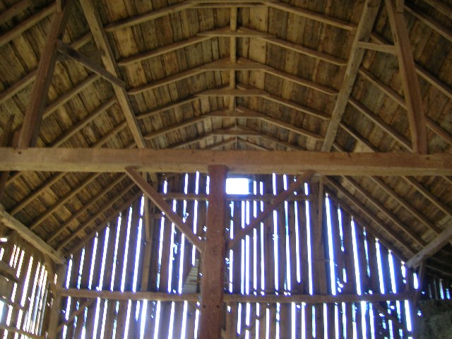
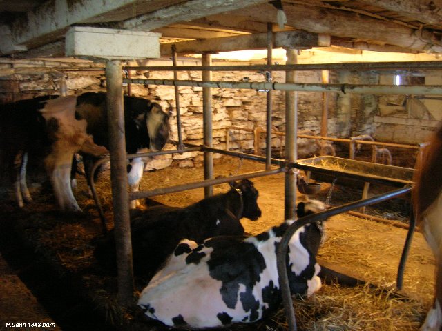
The inside of the Spencer barn, built by Alpheus Dann. This is the north ,or original half. The south half was skidded from a different location aned spliced onto it many years ago. The eastern sections are later additions.
This is a springtime photograph and the loft is empty... an October picture would show nothing but hay bales stacked to the roof.
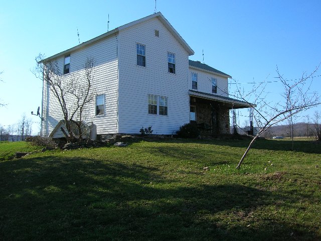
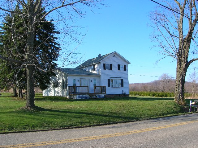
The Spencer house in 2007. The section facing the camera was originally constructed by Margaret and her father Robert Barker in the mid 1870s after Alpheus' original home burned. The balance of the front part, behind the porch, was added by her grandson Ray Barrow later on. The rear of the house, barely visible in the 1950s photo, was a granary located some distance west of the house, and was skidded over and spliced on to it.
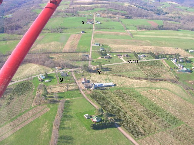
A photograph of Union Center, looking to the south. To my knowledge, Union Center was never a settlement, just the happenstance of a school, a church, and a cemetery. The Grange hall is the gray building near the "g" in the foreground. This was formerly the Swamp Baptist Church, and the Swamp School was directly accross the road (414) from it. The Swamp Cemetery is behind it, towards the camera from the "g". After the Grange took over the building, the dance hall located accross the road, to the right of the grange, was skidded over and attached to it.
The Spencer Farm is in the distance, near the "s". The homesite of the Van Hoesen family was accross the road to the right of the church, at the "v".Their daughter Helen taught for a while at the school, and their daughter Angeline married A.J. Dann.
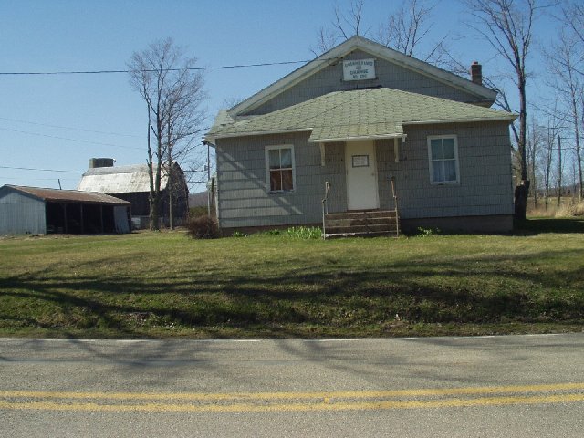
The Swamp Grange, in earler years the Swamp Baptist Church.
This is the "black house" mentioned by Marie Scudder Sullivan in
another part of the site, the house where Margaret moved after signing the farm over to her grandson Ray. Diane remembers it as being covered with tarpaper when she was young. This is the Barker Family's original homesite, and the swamp cemetery was initiated with the burial of their young grandson behind their home, in the early 1850s. The house is just east of the Swamp Grange.